Ten unmissable experiences along Mpumalanga’s Panorama Route
Follow Mpumalanga’s Panorama Route along the edge of the escarpment for beautiful waterfalls, canyon viewpoints, and historic towns.
🔴NOW OPEN | Wagterskop 4x4 Tyreworx Hoedspruit:
Pop in, say hello, and see what we’ve been working on and what we can offer you.

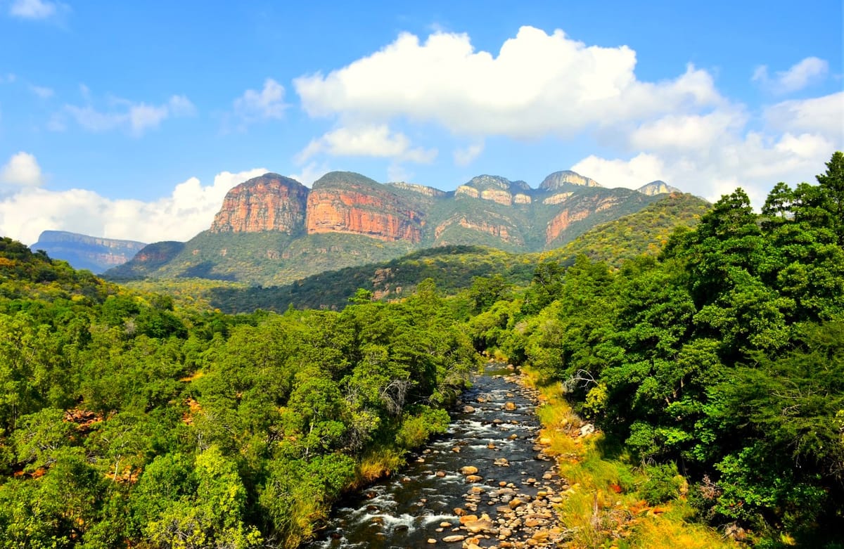
The Panorama Route traces the edge of the Mpumalanga escarpment, where the Highveld drops dramatically towards the Lowveld.
Running primarily along the R532 with connecting loops via the R534 and R535, this compact yet layered route unfolds over roughly 100 kilometres.
It is close enough to major towns like Graskop, Sabie, and Hoedspruit to feel accessible, yet varied enough to reward a full day or an unhurried overnight stay.
Pine plantations give way to indigenous forest, cliffs open into river valleys, and history quietly surfaces between waterfalls and lookouts. What makes the Panorama Route memorable is not a single viewpoint, but the way landscapes shift subtly from stop to stop:
1. Graskop Gorge Lift Company
On the edge of Graskop, a glass-fronted lift descends 51 metres into a forested gorge. At the bottom, elevated walkways lead through indigenous trees and along the Motitsi River. The contrast between the busy town above and the cool, shaded forest below sets the tone for the route.
2. God’s Window
One of the highest accessible viewpoints on the escarpment, God’s Window sits more than 1,700 metres above sea level. A short walk through the forest leads to viewing platforms overlooking the Lowveld plains. Clear days offer visibility stretching far beyond the immediate canyon, while mistier conditions add a quieter, introspective mood.

3. Lisbon Falls
Located just off the R532, Lisbon Falls drop nearly 95 metres into a narrow gorge. Named by Portuguese settlers during the gold rush era, the falls are strongest after summer rainfall, though their vertical drop makes them impressive year-round.
4. Berlin Falls
A few kilometres away, Berlin Falls present a more symmetrical cascade. Water flows evenly over a horseshoe-shaped cliff into a deep pool below. The surrounding grassland and open viewpoints make this a comfortable stop for lingering.
5. Bourke’s Luck Potholes
At the meeting point of the Blyde and Treur Rivers, centuries of erosion have carved smooth cylindrical hollows into the rock. Walkways and bridges guide visitors safely across the chasm, offering views directly into the swirling formations that gave the site its name.
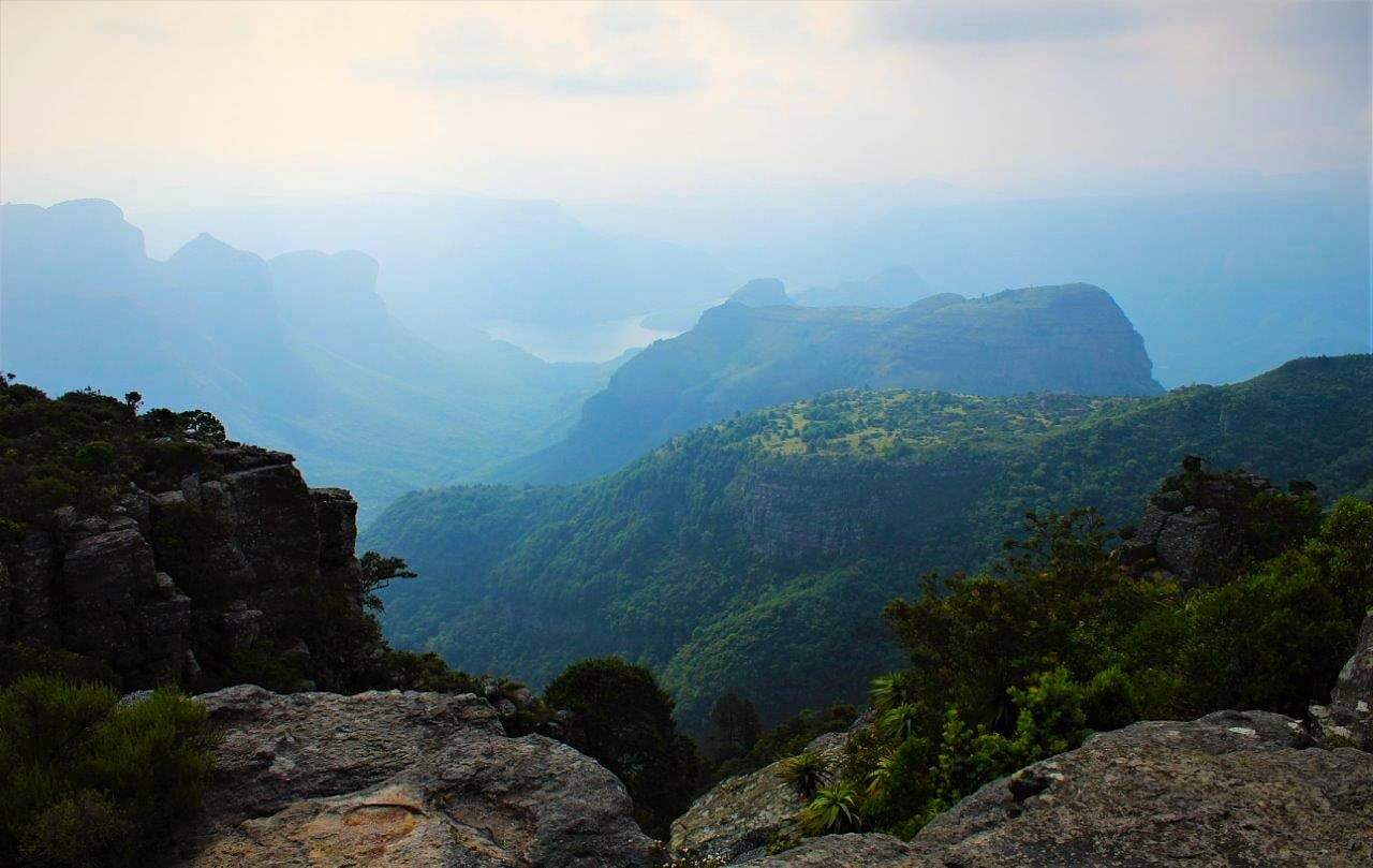
6. Three Rondavels
These round, dome-shaped peaks rise prominently above the Blyde River Canyon. Best viewed in softer morning or late afternoon light, the lookout provides a wide panorama across the canyon and river far below, with the peaks resembling traditional huts from certain angles.
7. Blyde River Canyon viewpoints
Beyond the Rondavels, several lesser-known viewpoints dot the R532. Each reveals a slightly different perspective on the canyon’s scale and vegetation. Short walks from roadside parking areas lead to quiet railings where the vastness of the landscape speaks for itself.
8. Pilgrim’s Rest
Once a thriving gold mining settlement, Pilgrim’s Rest has been preserved as a living museum. Original buildings, gravel streets, and period signage recreate the feel of the late nineteenth century. Small cafés and pubs offer a convenient pause between viewpoints.
9. Mac Mac Falls
Near Sabie, Mac Mac Falls split into twin streams as they plunge into a wooded gorge. The falls are easily accessible and well signposted, with nearby forest walks adding depth to the stop.
10. Sabie forests and timber roads
The roads around Sabie wind through some of South Africa’s most productive timber plantations. Early mornings often bring low-hanging mist, while viewpoints along the way reveal how forestry and indigenous woodland coexist along the escarpment.
The Panorama Route is not about rushing from one landmark to the next. Its real pleasure lies in the transitions, the changing light, and the way each stop adds context to the last.
🔴 You might also like:


Comments ()