Kruger National Park after the January 2026 floods
Heavy rains in January 2026 reshaped parts of Kruger National Park, altering roads, camps, and wildlife movements.
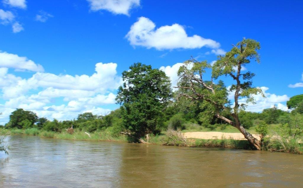
Summer storms across northeastern South Africa have always shaped life in and around Kruger National Park. January 2026 brought unusually intense rainfall, swelling rivers such as the Letaba beyond its banks. Roads washed away, low-water bridges disappeared under churning currents, and several camps faced temporary closures.
For travellers planning visits in the months that followed, the floods became both a logistical concern and a reminder of nature’s formidable rhythms.
Kruger’s vastness means flood impacts vary widely across its nearly two million hectares. Southern regions near Skukuza experienced riverine flooding that disrupted access routes and damaged sections of gravel roads.
In central zones around Satara, saturated soils and fallen trees slowed maintenance efforts. Northern areas, often drier, saw flash floods reshape seasonal drainage lines and alter game-viewing patterns.
Park authorities moved swiftly to assess infrastructure. Rangers, engineers, and conservation staff collaborated to repair bridges, clear debris, and restore essential services. Temporary detours guided visitors around vulnerable sections, while updated gate information helped manage entry flows.
Such coordinated responses highlighted the complexity of maintaining tourism facilities within a living ecosystem.
Wildlife behaviour shifted subtly after the floods. Grazing plains burst into fresh green growth, attracting herds of zebra and wildebeest to newly revitalised areas. Predators followed predictable prey movements, offering rewarding sightings for patient observers.
Birdlife thrived around expanded wetlands where egrets and storks foraged among receding pools. Photographers found dramatic reflections and moody skies that added depth to early morning drives.
Travellers returning to Kruger during this period encountered a park in transition. Some picnic sites remained closed, while popular loops reopened gradually. Dusty winter landscapes transformed into lush corridors framed by flowering shrubs and tall grasses.
River crossings demanded caution, particularly after late afternoon thunderstorms. Checking daily updates at camp receptions became part of the routine. Local communities surrounding Kruger also felt the floods’ effects. Roads connecting villages to tourism hubs like Hazyview and Phalaborwa required urgent repairs.
Informal traders dependent on visitor traffic faced uncertain weeks as recovery unfolded. Supporting community markets and locally owned lodges helped sustain livelihoods during the rebuilding phase.
Despite disruptions, the floods reinforced Kruger’s enduring appeal. The park’s ecosystems depend on cyclical extremes. Floodwaters replenish aquifers, redistribute nutrients, and reshape habitats in ways that sustain biodiversity over time.
Travellers who approach post-flood journeys with flexibility often gain richer insights. Adjusted itineraries lead to quieter viewpoints or unexpected encounters with wildlife reclaiming altered terrain. Conversations with guides reveal stories of resilience and adaptation that seldom appear in glossy brochures.
Kruger National Park, after the January 2026 floods, stands as a living testament to nature’s power and recovery.
Visiting during such periods offers more than sightings. It invites reflection on the delicate balance between tourism infrastructure and ecological continuity.


Comments ()